Uzbekistan is geographically organized into 12 regions, namely Andijan, Bukhara, Jizzakh, Kashkadarya, Navoi, Namangan, Samarkand, Sirdarya, Surkhandarya, Tashkent, Fergana, and Khorezm. Additionally, it includes the autonomous Republic of Karakalpakstan.
The administrative division consists of 162 districts and 118 cities, with over 42% of the population residing in urban areas. Tashkent, the capital, stands as the largest city with a population of 2.3 million. Notably, Tashkent hosts over half of the Russian population in Uzbekistan, accounting for around 30% of the city's total inhabitants. Following Tashkent, Namangan ranks as the second-largest city with 398 thousand residents, succeeded by Samarkand (366 thousand), the former capital of the Uzbek SSR until 1930. Significant cities in the Fergana Valley include Andijan (356 thousand), Fergana (320 thousand), and Kokand. It's worth mentioning the historic city of Bukhara (271 thousand), a prominent cultural and political center for the Uzbek people throughout history. Lastly, Nukus, with a population of 260 thousand, serves as the capital of the autonomous republic of Karakalpakstan.
Andijan
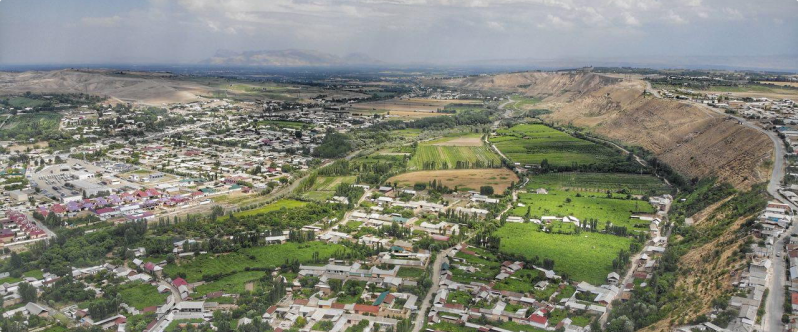
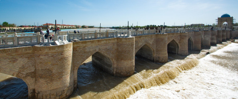
Known by its former names Andukon and Andigon, Andijan is situated in the eastern region of the Fergana Valley, resting upon the historic sediments of the Andijan-sai River. Positioned 260 kilometers southeast of Tashkent (accessible by a 385-kilometer road journey) and 40 kilometers northwest of Kyrgyz Osh, Andijan encompasses an area of 4200 square kilometers. Regarded as an ancient city and often described as the jewel of the valley, Andijan has roots dating back to the 9th century. It is recognized as one of the oldest cities situated along the Great Silk Road, strategically positioned in the southeastern part of the Fergana Valley, embraced by towering mountains and situated alongside the Andijan-sai river. Although the precise founding date remains undetermined, Andijan boasts a rich history, distinctive traditions, and a unique agricultural heritage.
Bukhara
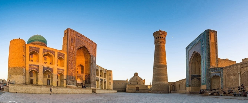
Derived from Sogdian, the term "Bukharak" translates to "successful location." Serving as the focal point of the Bukhara region, Bukhara stands as one of the oldest cities in Uzbekistan, boasting a history spanning over 2500 years. During ancient times, it constituted a part of the Sogd region, a key area in Central Asia. For centuries, camel caravans traversed Bukhara along the Great Silk Road, facilitating the transportation of goods between China and Europe. Beyond its significance in trade, Bukhara emerged as a notable center for Islam, earning the esteemed title of "Bukhoro-i-Sharif" or "Great Bukhara" among Muslims. Recognized as one of the seven holy cities of Islam, Bukhara is renowned for its impressive architecture and profound historical legacy. The city has preserved structures that encapsulate thousands of years of history, standing as the oldest center that has remained remarkably unchanged for the past two centuries.
Gulistan
The name Gulistan has its roots in Persian, translating to "flower garden" or "rose garden." Gulistan is a city situated in the southeastern part of the Hungry Steppe, serving as the central hub of the Sirdarya region in Uzbekistan. Positioned on the left bank of the Syrdarya, it is located 118 km away from Tashkent, marking the exit from the Fergana Valley. Previously known as the Hungry Steppe (until 1922) and Mirzachul (until 1961), Gulistan underwent a name transition. In 1990, following the reestablishment of the Jizzakh region, the center of the Sirdarya region was relocated from Jizzakh to Gulistan.
Jizzakh
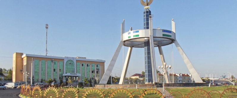
The city's name, Jizzakh, originates from the Sogdian term "small fort." Jizzakh serves as the administrative center of the Jizzakh region in Uzbekistan. Positioned on the Sanzar River, at the northern base of the Nurota Mountains, the city is situated 180 km southwest of Tashkent and 90 km northeast of Samarkand.
Jizzakh has historical roots dating back to the 10th century when it emerged as a pivotal point in the oasis along the Silk Road, connecting the Fergana Valley to Samarkand. Originally part of Kazakhstan since the establishment of the Kazakh SSR, the Jizzakh region was transferred to Uzbekistan in 1956, marking Jizzakh's status as an Uzbek city.
Karshi
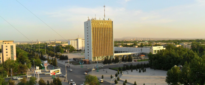
Karshi, historically known as Nakhshab, Nasaf, and Bek-Budi, serves as the administrative center of the Kashkadarya region. Positioned within the Karshi oasis along the Kashkadarya River, the city is situated approximately 520 km south-southwest of Tashkent and 335 km north of the Uzbekistan-Afghanistan border.
The city's rich history traces back to the 7th century BC, showcasing its significance as a resilient stronghold against invaders, with the local population consistently offering fierce resistance. Karshi is strategically positioned on the ancient caravan route connecting Samarkand and Bukhara to Afghanistan and India. In the early 1970s, an irrigation canal from the Amu Darya was directed to Karshi, and the city holds importance for natural gas extraction.
Navoi
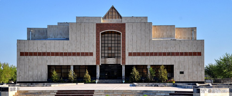
Navoi, situated in the southwestern region of Uzbekistan within the Zarafshan valley, stands 360 km southwest of Tashkent and serves as the administrative center of the Navoi region. The city, established in 1958, was named in tribute to the esteemed Uzbek poet Alisher Navoi and was part of Kazakhstan within the Hungry steppe region during the foundation of the Kazakh SSR.
Originally, both the city and the region were under the jurisdiction of Kazakhstan. However, in 1956, the Hungry steppe region, encompassing present-day Navoi and Dzhizak regions of Uzbekistan, was transferred to Uzbekistan. Designed by architects from Leningrad, Navoi rapidly developed into a prominent industrial center within the republic, gaining renown for the Navoi mining and smelting complex.
Namangan
Namangan, situated in the eastern part of Uzbekistan, derives its name from the Persian term "Namak Kann," signifying a "salt mine." The city is positioned in the northern region of the Fergana Valley, approximately 430 km southeast of Tashkent, and serves as the administrative hub of the Namangan region, a designation established following Uzbekistan's attainment of independence. Historical records indicate the first references to Namangan emerged towards the end of the 15th century. The city of Namangan and the former Davlatabad district now constitute a unified administrative and territorial entity.
Presently, Namangan stands as one of the republic's major industrial centers. Key sectors driving Namangan's economy include cotton ginning, machine manufacturing, electrical engineering, chemicals, and food production.
Nukus
Nukus, positioned as the capital of the Republic of Karakalpakstan, stands as the largest city within this republic. Situated in the central region of Karakalpakstan on the right bank of the Amudarya River, it is located 800 km northwest of Tashkent. The city's southern and eastern sectors are enveloped by the "Kizil Kum" (red sand) desert, while its northern part is adjacent to the Amudarya delta.
The ecological conditions, not only within Nukus but across the entirety of Karakalpakstan, have become highly challenging due to the Aral Sea's desiccation. Additionally, the utilization of pesticides in the vicinity of Nukus has resulted in severe environmental contamination.
Samarkand
Samarkand, known in ancient literature as Sogdiana (Sogd.) and Marakand (Greek), stands as the second-largest city in Uzbekistan, serving as the focal point of the Samarkand region.
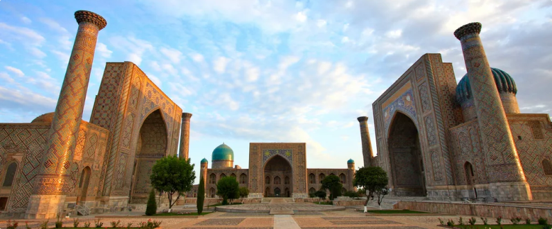
With a history spanning 2750 years, Samarkand is recognized as one of the oldest cities globally and has held strategic importance for over two millennia along the Great Silk Road. Over the centuries, the city endured conquests by Alexander the Great's soldiers, the forces of the Arab Caliphate, and the Mongol hordes of Genghis Khan. Despite facing numerous destructions and fires, Samarkand was repeatedly revived, expanding to become the capital of significant Central Asian states. Notably, it served as the capital of Tamerlan's vast empire for an extended period. Today, Samarkand boasts a wealth of ancient architectural marvels, leading to its inclusion in the UNESCO World Heritage List in 2001.
Tashkent
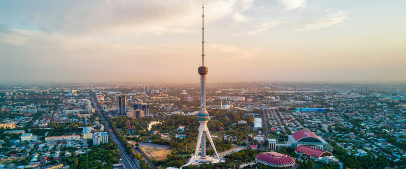
Tashkent, known by its former names Yuni, Chach, Shash (Madina? -Ash-Shash), and Binket (Binkt), serves as the capital of the Republic of Uzbekistan and the administrative hub of the Tashkent region. As the most populous city in Uzbekistan and Central Asia, Tashkent holds a prominent position as a key political, economic, cultural, and scientific center in the country.
Situated in the north-eastern part of the republic on the plain of the Chirchik River, Tashkent encompasses an area of 30 thousand hectares, with nearly half of the city now featuring landscaped areas. Administratively, Tashkent is divided into 11 districts. While its first mention dates back to the II BC, the city marked its 2,200th anniversary in 2009. Historically, Tashkent was not as sizable as its southern neighbors, Samarkand and Bukhara. However, significant transformations have occurred in Tashkent during the years of Uzbekistan's independence.
Termez
The name of the city, derived from the ancient Iranian term "tara-maiθa," translates to "place of transition" (tara-crossing, crossing; maiθa-place). In antiquity, Termez held significance as a crucial ferry point on the Amu Darya River.
Termez stands as the southernmost city in Uzbekistan and serves as the administrative center of the Surkhandarya region. Bordered by Turkmenistan to the west, Tajikistan to the east, and Afghanistan to the south, the city is positioned on the right bank of the Amu Darya. This river delineates the border with Afghanistan and converges with Surhandarya. Termez is located 490 km south-west of Tashkent.The city commemorated its 2500th anniversary in 2002.
Fergana
Previously known as New Margelan and Skobelev, the city of Fergana derives its name from two Persian words, "Paris" (meaning angel) and "Khona" (meaning house), translating to "House of angels" or "city of angels." Fergana stands as a city in eastern Uzbekistan, situated on the southern periphery of the Fergana Valley, and it serves as the administrative center of the Fergana region. Located 420 km east of Tashkent, the city was established in 1876 by M. D. Skobelev, the inaugural military governor who named it New Margelan. Fergana boasts a rich cultural heritage, being one of the oldest cultural oases in Central Asia.Recognized as a pivotal hub for oil production, Fergana played host to the construction of the first oil refinery in 1908.
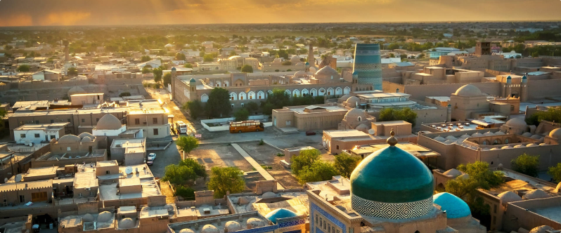
Khiva
Khiva, situated in the Khorezm region of Uzbekistan, was once referred to as Khorasmia in ancient times, and later adopted the names Khvarezm and Khorezm. The enduring history of Khiva is intricately tied to the destiny of Khorezm, making it one of the oldest cities in Central Asia. Nestled in the southern part of the Khorezm oasis, Khiva finds itself surrounded by the sandy expanses of the Karakum and Kyzylkum deserts to the south and northeast, respectively. Its origins trace back to the 10th century when it was initially mentioned as a small town. Over an extended period, Khiva evolved into a key center along the Great Silk Road, earning its rightful title as a city-museum set amidst an open landscape.
